
The Fondom of Awing
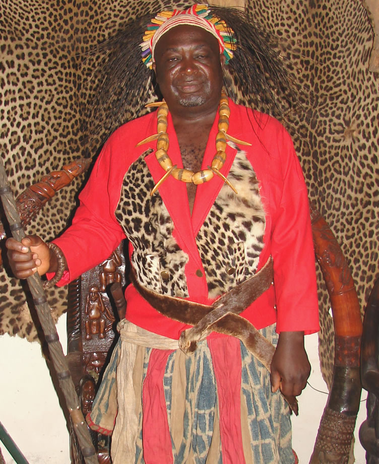
THE ORIGIN OF THE AWING PEOPLE, LOCATION OF AWING
History holds that the people of Awing are part of the Bantu clan who originated from parts of East Africa. Legend further holds that they came from the northern eastern parts of the Congo, passing through South Sudan before they finally got to Widikum area in the 16th century.
The Awings constitute part of a large group of four clans viz.: Moghamo, Meta, Ngie-Ngwo and the Ngemba (upper and lower). The Awing people are part of the upper Ngemba clan. After having settled in the Widikum area, that’s the Momo Division, they soon grow in need of more land for expansion. The quest for more land forced them to go seeking for a new place to settle as they moved towards the Mankon area passing through Tadkon. They moved alongside the people of Bambili, the Bamenyams and the Mankons. They are said to have arrived the Mankon area during the heart of the rainy seasons. The sheer volume of the Mezam River is said to have put a stop to their movement and they held on for a while.
They are said to have moved on to an area called Ndobu in the Bamensengue area in Mbouda, West Region. They later moved back towards the Northwest Region and settled around Ntarikon, named after their former ancestral site that was known as Tadkon.
Some accounts hold that the Mbuewing or Awing people who landed where they are found today were made up of nine clan heads. Each clan head had a symbol of power and authority on the arm, which was the traditional bangle. This bangle also represented the independence of each of the clans from the power of dominance by another. Thus, the clan heads expressed their power, authority and assertiveness over their different clans by the display of their bangles. The bangle was therefore accompanied as a symbol of authority in each of the clans by a clan-kwifor as the judicial body of the said clan. The clan members were known to bow and clap thrice as a sign or respect and honour to their clan heads. By this practice, peace and order reigned in all the clans. Thus the Mbuewing people at this time had many Clan Heads or Patriarchs. Thus, there was a tussle for supremacy as to who should be the supreme leader.
This tusle therefore led to to one of the Clan Heads, Mbangwashi, who hatched out a plan and proposed it to the other clan heads on what they should do to have a supreme leader or head. His proposal was to the effect that all of them, clan heads, will remove all their mystical bangles and keep together in a shrine and on the the following morning, whoever emerges from the shrine wearing all the nine bangles, would be considered as having been chosen by God to be their paramount ruler. Some of the clan heads bought Mbangwashi’s idea while others rejected it as a ploy by him to have one of his sons to become the Paramount ruler. Eight, nonetheless, surrendered their bangles to be kept in the shrine. Mbangwashi’s plan finally worked to his favour as his son finally emerged from the shrine as the chosen one with all the bangles to the dismay of all the other clan heads. But, the trick had already worked and there was nothing that the others could do to over turn the choice presumably chosen by God. So, this is how the Awing people came about to have their very first Paramount Fon and this effectively marked the founding of the village today known as Awing.
LOCATION OF AWING
Awing is a village with a sub divisional status in all its ramifications located in the Santa Sub Division of Mezam, North West Region of Cameroon.
Geographically put, it is located on an altitude of about 1,500 m above sea level. Topographically, the village location begins from the topper parts of Mount Lefo, which is the highest peak in the northwest Region, and spreads downwards the Mountain’s slopes and then, southwards. The downward and southern part of Awing is a low-lying u-shaped plain where the bulk of the people are settled.
It is surrounded by an extension of the chain of the Bamboutous Mountains to its west, north and eastern parts. In effect, a beautiful scenery of undulating hills, interspersed by rivulets flowing down its valleys, hems round the village. This low-lying u-shaped village has a land surface area of about 100 square kilometres. The village is partitioned into quarters and the seat of the Fondom is located in the Mbenten Quarters where the Fon’s Palace is located.
As already stated, Mt Lefo is the highest peak here with a height of 2550 m. On the northern flank of Mt Lefo is found the famous Lake Awing, which is a major tourist destination in Awing and Cameroon as a whole. The Lake also serves the Fondom as the most sacred of all its shrines.
Also very prominent in Awing are some two cone shaped hills commonly known as the nkonnewang and the kongmoh –mbingeu. These hills are covered by green vegetation made up of savannah grass, shrubs, dotted fig trees in some areas and forested portions in others. The hills serve the population as grazing land for those with cattle and farmland for those who do crop farming. The streams that flow down also serve to provide water for much of the villagers either for drinking or for the irrigation of their farms or vegetable gardens.